Geography
of Virginia
I read some interesting information about geography of Virginia:
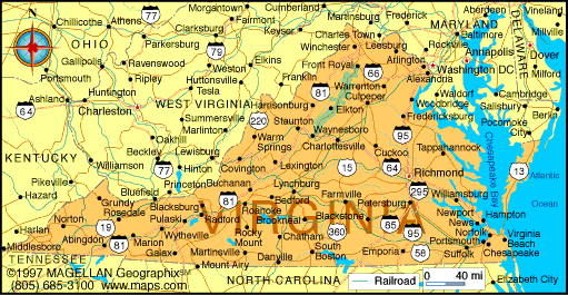
The most northerly of the
Southern states, Virginia is roughly triangular in shape. The small
section of the state that, along with Maryland and Delaware,
occupies the Delmarva peninsula
between Chesapeake Bay and the Atlantic Ocean is separated from the main part
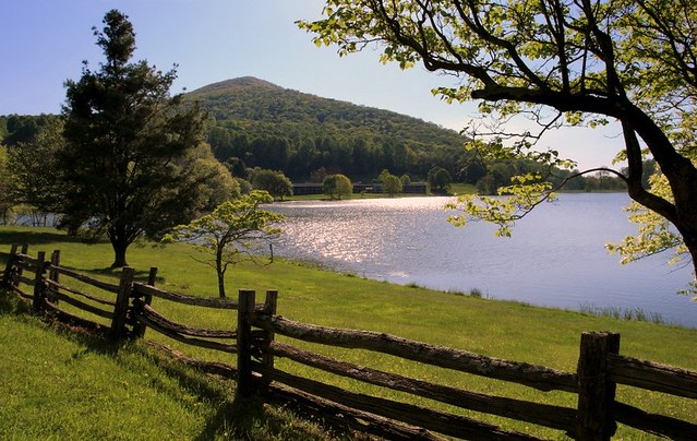
of Virginia and is called the Eastern Shore. The coastal plain
or tidewater region
of E Virginia, generally flat and partly swampy, is cut by four great tidal
rivers—the Potomac (forming most of the border with Maryland and
beyond which also lies Washington, D.C.), the Rappahannock, the York,
and the James—all of which empty into Chesapeake Bay. In the tidewater
region stretch vast forests of pine and hardwood, highlighted
in early spring by flowering redbud and dogwood.
 Virginia's
shores, mountains, mineral springs, natural wonders, and numerous historic
sites draw millions of visitors annually. Crowning the hilltops and river
bluffs from the Chesapeake region west to the
Blue Ridge and adding to the grace and elegance of the Virginia landscape are the classic Greek
revival homes and public buildings with their stately porticoes. Major tourist
attractions include Shenandoah National Park; Colonial
Williamsburg; and Arlington House, The Robert E. Lee Memorial. Other hCourt House National Historical
Park; Manassas
and Richmond national battlefield parks; Booker
T. Washington and George Washington Birthplace national monuments; Colonial National
Historical Park
and Jamestown National Historic Site, both on Jamestown Island;
and several national cemeteries and battlefields (see National Parks and Monuments, table).
Virginia's
shores, mountains, mineral springs, natural wonders, and numerous historic
sites draw millions of visitors annually. Crowning the hilltops and river
bluffs from the Chesapeake region west to the
Blue Ridge and adding to the grace and elegance of the Virginia landscape are the classic Greek
revival homes and public buildings with their stately porticoes. Major tourist
attractions include Shenandoah National Park; Colonial
Williamsburg; and Arlington House, The Robert E. Lee Memorial. Other hCourt House National Historical
Park; Manassas
and Richmond national battlefield parks; Booker
T. Washington and George Washington Birthplace national monuments; Colonial National
Historical Park
and Jamestown National Historic Site, both on Jamestown Island;
and several national cemeteries and battlefields (see National Parks and Monuments, table).

Hi
ReplyDeleteYou have done a great job!
Interesting information, exciting pictures,
but it would be better to put more links.
Thank you!